
My River,
OUr Refuge
A Vision to expand on existing community and ecological assets to celebrate, reconcile, and reconnect with our River.
A vision to expand on existing community and ecological assets to celebrate, reconcile, and reconnect with our River.

Authentic Sonoran Bio/Cultural Diversity
Cultural Water:ways
Honoring Indigenous stewardship, diverse traditional cultural practices, natural heritage, and the many meanings of water.
Learn more here.
Our Work
Urban Ecological refugia
Ecological Over:flows
Restoring riparian habitat, reconnecting fragmented ecosystems, and supporting endangered species recovery.
Learn more here.

A wellspring of stewardship
Community Cienegas
Building long-term pathways for co-management, equitable access, coordinated information sharing, and shared care for our desert river oasis.
Learn more here.
Project snapshot
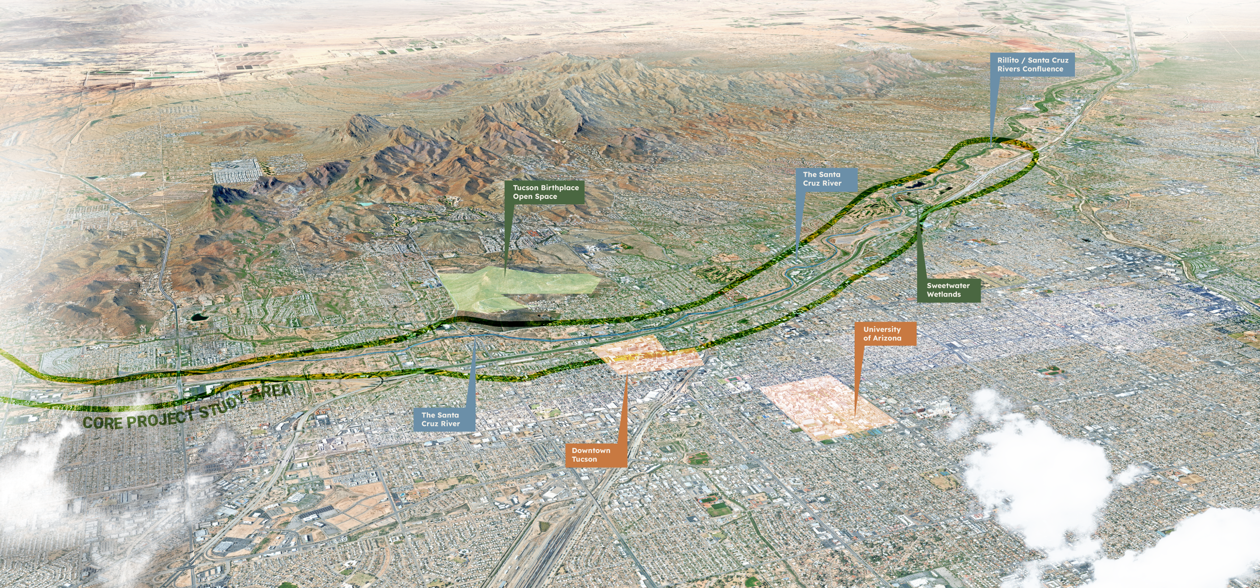
Focused on Tucson but coordinated with broader efforts and applicable resources for the full river, this two year grant funded project is conducting outreach and engagement on the diverse priorities and preferences of communities and barrios future relationship with the Santa Cruz River lands, water, wildlife, and one another.
Our project team has a plan moving forward that will include developing a summary of community preferences/priorities, a portfolio of refuge sites anchored in a long-term vision for habitat restoration and ecosystem stewardship. We’ll share our findings along the way, and we welcome your input at every stage. Please join us at an event or sign up for our newsletter here!
Reconciliation with the Santa Cruz: A Living River, A Shared Future
The Santa Cruz River once connected people, wildlife, and cultures across southern Arizona. Today, a growing coalition is working to revive that connection — and they’re inviting the community to help imagine what a living river can mean for the future of Tucson.
Building a Movement
At the heart of this effort is the Santa Cruz River Refuge Coalition, which brings together local community leaders. Advisory Council briefings with local, regional, and national partners ensure that community voices are heard and that the work stays aligned with the region’s needs.
Understanding the River’s Ecology
Before we can rehabilitate the River, we need to understand its current ecological condition. Building on three decades of conservation planning, researchers are now surveying potential refuge sites, mapping habitat opportunities, conducting baseline ecological assessments, and identifying where new refugia could have the biggest impact for wildlife and people alike.
Designing Tools for the Future
Reviving a river requires lasting stewardship. The project is developing tools and strategies for long-term care of the river, exploring options like community land trusts, shared ownership models across tribal, city, and county jurisdictions, and funding approaches that prevent displacement and “green gentrification.”
Listening to the Community
Community voices are at the center of the project. Over the next year, the team will host large public events and community workshops. Gatherings will invite youth, families, and neighbors to share stories, create maps of local assets, and imagine the future of their neighborhoods and the River’s corridor through the city. Participants will also roll up their sleeves for hands-on ecosystem restoration activities and community projects.
Planning for Wildlife Migration
Once the science and community visions are in place, the team will weave them together into a Wildlife Refugia Vision Framework — a network of connected refugia along the river. Conceptual designs and renderings of the priority sites will show how land could be transformed into thriving habitat corridors and stepping stones.
Measuring What Matters
The project is also committed to measuring success in three dimensions — ecological, social, and economic. Researchers are tracking riparian health, documenting community benefits, and estimating the economic impacts of ecosystem restoration to ensure that the river’s revival lifts up the people who live near it.
Taking the Next Step
Finally, the project will host workshops to bring together coalition members and new partners to identify funding opportunities and write grants. The goal of these workshops is to move from planning to action by securing resources to rehabilitate and protect these sites for future generations.
Diverse River Community
The Santa Cruz River is the lifeblood of the region since time immemorial. These flowing waters have sustained people, wildlife, and cultures. The River flows through Indigenous lands, including those inhabited by the O’odham and Yaqui Tribes, with deep cultural connections with the river and land. The corridor also has a rich history shaped by Spanish, Mexican, and American influences, with notable landmarks such as the Juan Bautista de Anza National Historic Trail, Tumacácori Mission, and San Xavier Mission.
Tribal Sovereignty
This effort prioritizes Tribal sovereignty. It seeks to foster land stewardship and cultural awareness of Tucson’s rich, diverse heritage through conservation, ecosystem restoration, recreation, and education. There are many ways that a refuge can be managed and examples include those that are either managed by federal agencies (e.g. U.S. Fish and Wildlife Service) or via a co-stewardship agreement between FWS and a. There are many refuges co-stewarded by a Tribal government, Nation, Pueblo, or public entity and FWS. Often, the Tribe maintains ownership of refuge property, and thus ultimate decision making power over management and public access. In these agreements, the Tribe can gain conservation funding from FWS to further land ecosystem restoration and outdoor access for Tribal residents. In some cases, the Tribe also regains ancestral land.
no forced acquisition, tribal sovereignty, public access & retaining barrio rancheria land uses
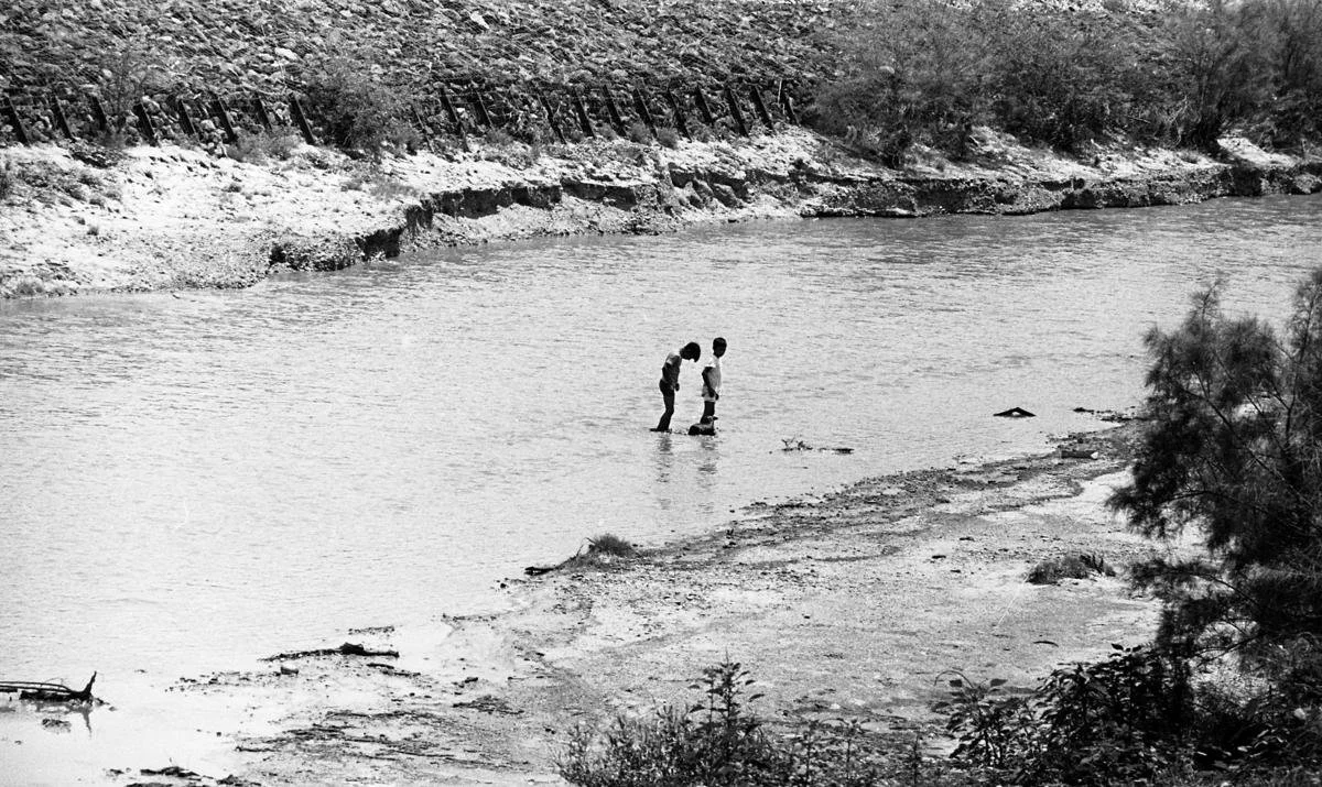
Photo: Tucson Historical Society ‘Boys in River’
Critical Riparian Corridor
Flooding was a natural part of the Santa Cruz River, especially during the Monsoon season. This became viewed as problematic in the 1900’s as development patterns pushed agriculture and other uses into the floodplain. Rich networks of side channels were altered to increase acreage for agricultural production, decreasing the flood capacity of the overall system.
The river also holds stories of erasure and removal, of both people, and ecological function through elimination of rich biodiverse braided floodplains.
The O’odham community of Chuk:son stewarded the Santa Cruz River for at least 4,500 years, working with flood cycles to cultivate food in the Sonoran Desert. In 1775, a Spanish fort was established in the heart of what is now downtown Tucson. When Mexico gained independence from Spain in 1821, Tucson became a part of Sonora, Mexico. The U.S. acquired Tucson and Arizona south of the Gila River from Mexico in the Gadsden Purchase between 1853 and 1854.
Between 1880 and 2005, the population of Tucson increased from 5,000 to 1,000,000 residents, drastically changing water demand and land uses in the Santa Cruz River basin. As overextraction continued, perennial flows in downtown Tucson ceased in 1915 and by 1940, reliable seasonal baseflows in the river ceased. But the Santa Cruz River was far from dead.
With rapid growth occurring along the river, Tucson was unprepared for the devastating 1983 flood. Rivers overtopped their banks, sewer lines were destroyed, major bridges closed, and hundreds of people sought safety on rooftops. Nine people died, making it the deadliest flood in the County’s history. In response, Pima County built innovative soil cement embankments that have effectively prevented a disaster of that scale from recurring.
To further reduce future flood risks and preserve natural floodplain function, the County began purchasing flood damaged and flood prone lands from willing sellers. In 2026, where the steep soil cement levee limited wildlife movement, the Regional Flood Control District added a first of its kind wildlife ramp near El Rio Preserve, maintaining flood protection while allowing wildlife to cross the river. Expansion of these efforts will help to reconnect the waters, land, people and wildlife safely.
Over time, the County’s preserve system, the Regional Flood Control District’s efforts, the Sonoran Desert Conservation Plan, and the City’s riparian ordinances have helped protect open space, habitat, and wildlife connectivity. In 2025, Pima County, the City of Tucson, Santa Cruz County, and the U.S. Fish and Wildlife Service signed an agreement creating the Santa Cruz River Wildlife Partnership, with the Tohono O’odham Nation’s San Xavier District also endorsing the concept of a Refuge. This agreement strengthens potential for collaboration on environmental education, outreach, and conservation while protecting a vital wildlife corridor along the Santa Cruz River.
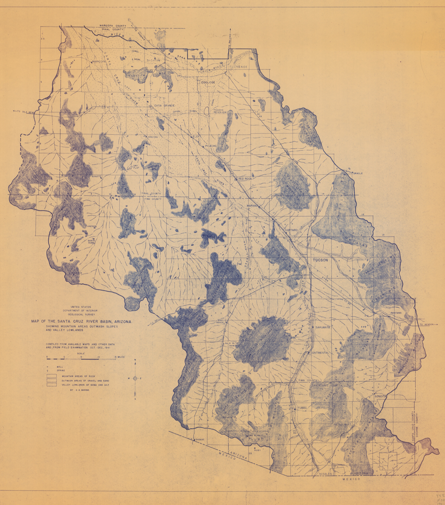
United States Department of the Interior, Map of the Santa Cruz River Basin, Arizona, Showing Mountain Areas Outwash Slopes and Valley Lowlands, [G4332.S384_1941.jpg]. Arizona Memory Project, accessed 15/04/2025, https://azmemory.azlibrary.gov/nodes/view/273997
Flowing Waters
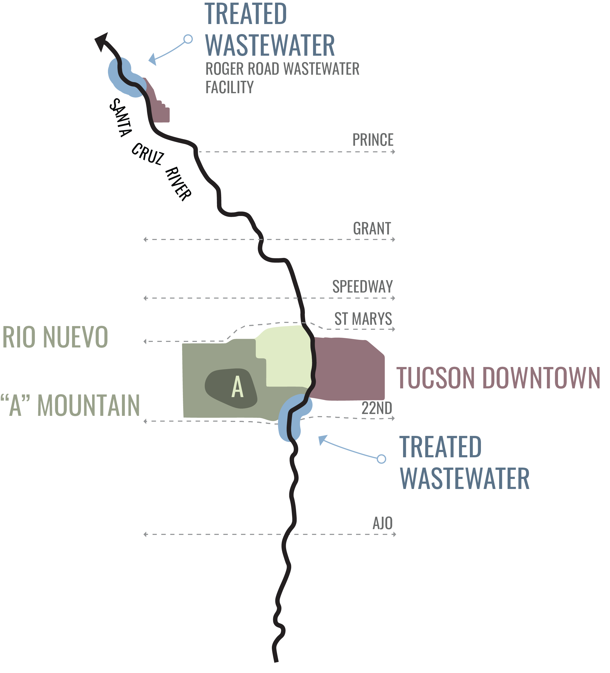
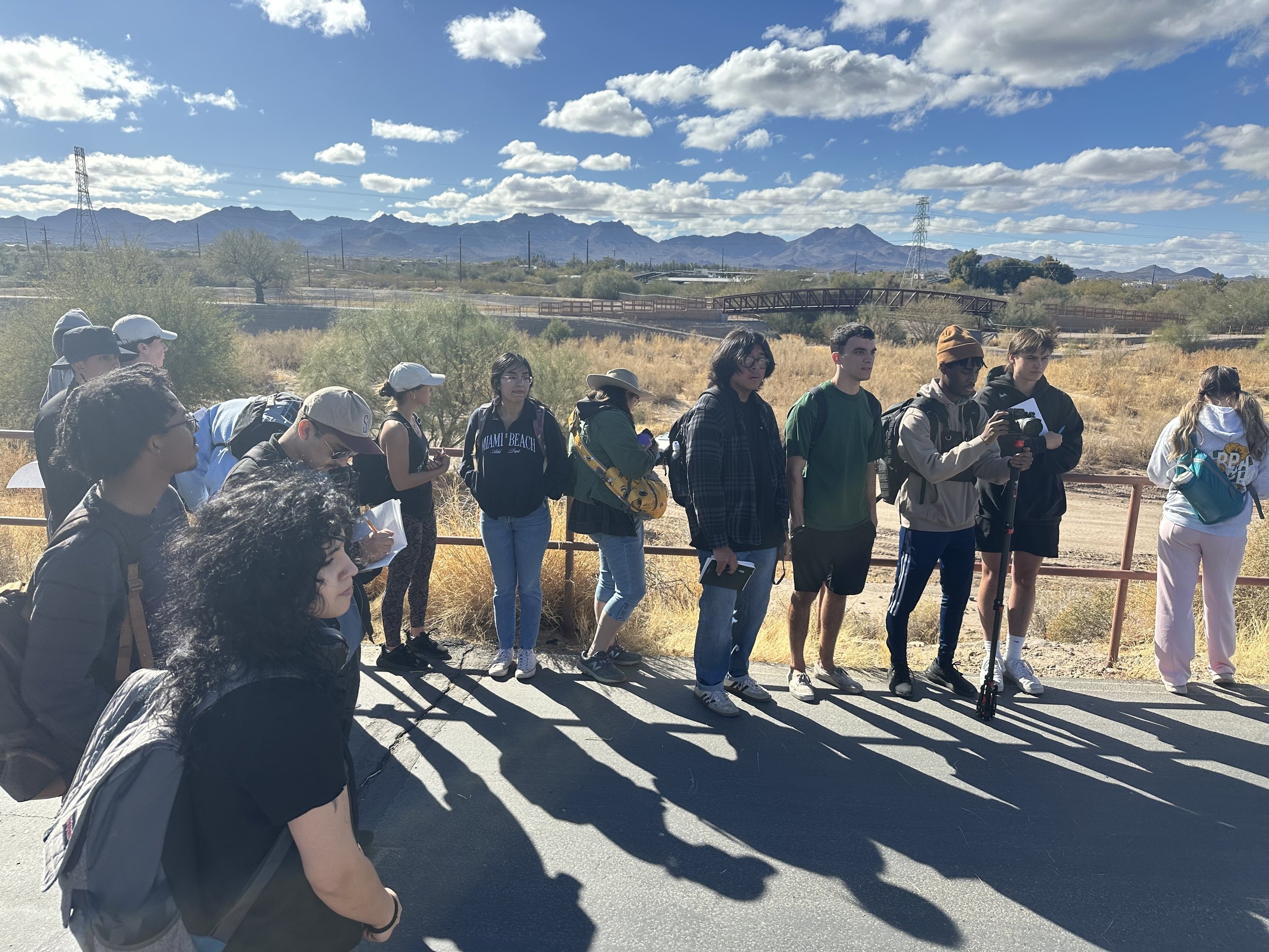
Although water is scarce a rich network of desert rivers persist throughout the city. Since the 1970’s, thanks to a policy of regional collection of precious wastewater and the release of the cumulative effluent (treated wastewater) into the river, over 20 miles of the Santa Cruz River flow year-round. The community responded by building numerous river parks and The Loop recreational trail to provide easier access to this river bounty from birders and hikers to bikers and equestrians. Then in 2014, the quality of the effluent being released vastly improved and additional discharge points were added over time from reclaimed water sources. further supporting the recovery of vegetation, fish, wildlife, insects, and migratory birds. The river corridor, stretching from the Mexican border to the north of Marana, has become a transformational hub of ecological recovery and recreational opportunities.
Biodiverse Ecosystem
The Santa Cruz River Basin, spanning the Sonoran Desert and native grasslands, hosts extraordinary biodiversity, with 80% of regional wildlife relying on the river and at least 22 threatened and endangered species. Once degraded by poorly treated wastewater, the river now flows with clean effluent across 40+ miles, supporting improved habitat, wildlife recovery, recreation, and local economic development, thanks to major wastewater treatment upgrades in the last 10–15 years. Though lacking federal recognition, the Santa Cruz River has been extensively monitored by academics, nonprofits, county staff, and community scientists. Research and community engagement track aquatic invertebrates, fish, birds, butterflies, amphibians, reptiles, and riparian plants—data that would be expanded by federal designation and protection.
Aquatic invertebrates
Over 250 aquatic invertebrate species have been documented at eight long-term monitoring sites, most appearing after water quality improved post-2013. Dragonflies and damselflies, numbering more than 60 species, are key bioindicators and have flourished in rehabilitated reaches, with over 6,400 community observations contributing through festivals and iNaturalist, reflecting strong public engagement.
Fish
Annual surveys led by the Sonoran Institute and partners have identified at least ten fish species, including abundant populations of the native longfin dace and endangered Gila topminnow at multiple sites. While four historically native species have been lost, ecosystem restoration and consistent effluent flows help sustain fish populations and could enable reintroduction of extirpated species.
Birds
With over 300 bird species documented along the river, bird diversity has rebounded quickly in response to restored flows and regrown riparian habitat. Systematic research and more than 48,000 eBird checklists highlight the presence of endangered species like the Yellow-billed Cuckoo and Southwestern Willow Flycatcher, underscoring both scientific and community-driven conservation value.
Butterflies
Southern Arizona’s high butterfly diversity extends to the Santa Cruz River, where at least 73 species have been observed through nearly 5,000 community-science records. Though formal monitoring is limited, interest is growing, particularly in conservation of monarchs, which have been recorded over 50 times, suggesting strong potential for habitat-focused ecosystem restoration to expand butterfly diversity.
Amphibians and reptiles
More than 30 amphibian and reptile species inhabit the Santa Cruz River corridor, with nearly 3,000 community-science observations and new systematic monitoring by students. Flow ecosystem restoration has bolstered toad and turtle populations, while rare species such as the Sinaloan narrow-mouthed toad have also benefited. Opportunities for reintroducing endangered species like the Mexican gartersnake also exist.
Riparian plants
At least 700 plant species have been recorded along the river, with recent surveys linking greater species richness to effluent flow releases. Community scientists have contributed nearly 11,000 observations, while ongoing university and K-12 collaborations monitor riparian diversity. Ecosystem restoration could also enable reestablishment of endangered wetland plants like the Huachuca water umbel and Arizona eryngo.
Benefits of a refugia plan
A Wildlife Refugia Network Vision Framework would support ongoing and expanded habitat enhancements for endangered species, support cooling ecosystem services, strengthen habitat connectivity, and expand ecotourism and recreation, ensuring lasting conservation for the river, its wildlife, and its communities.
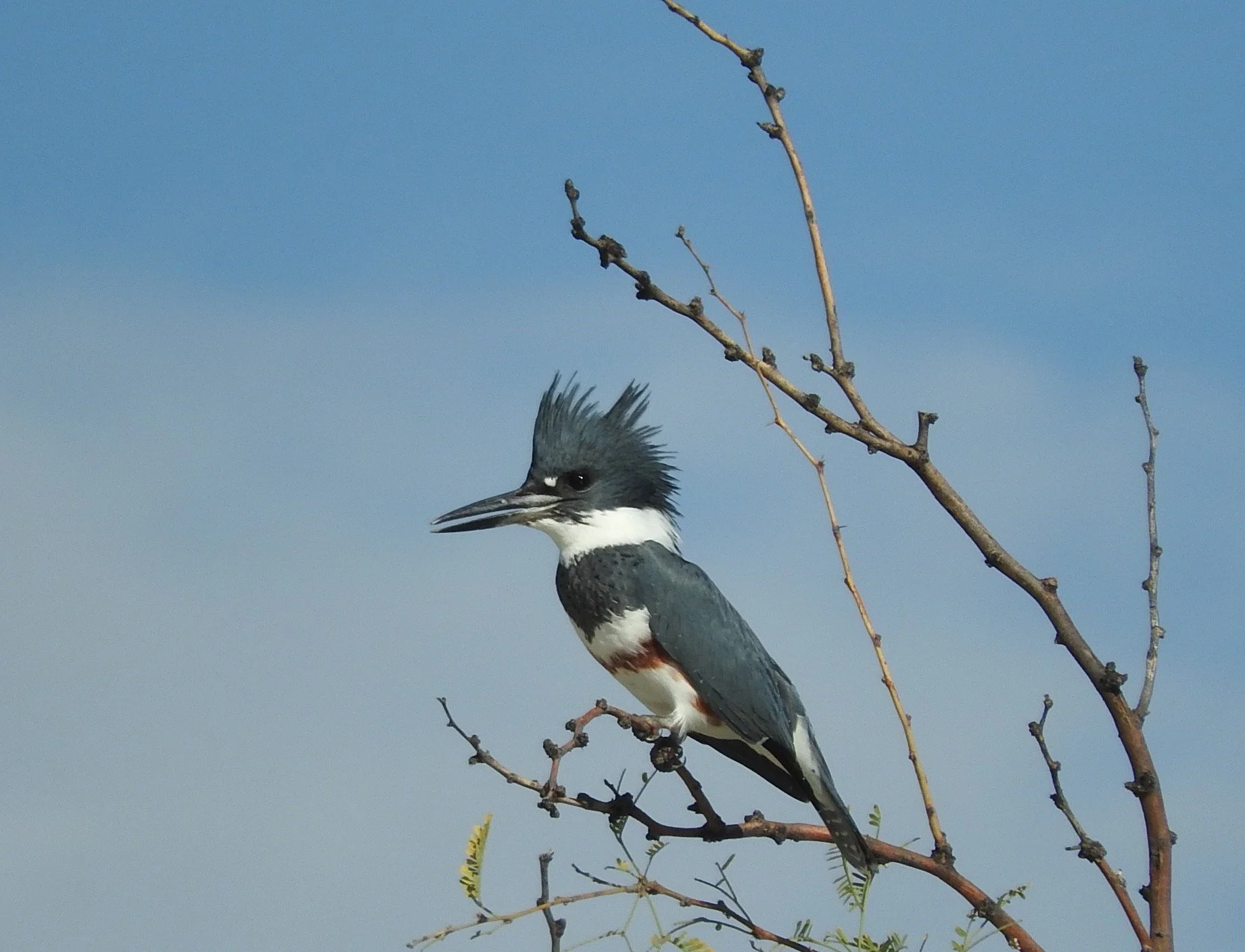
Belted KingFisher
Megaceryle alcyon
Photo: Janey Smith

Sonoran desert tortoise
gopherus morafkai
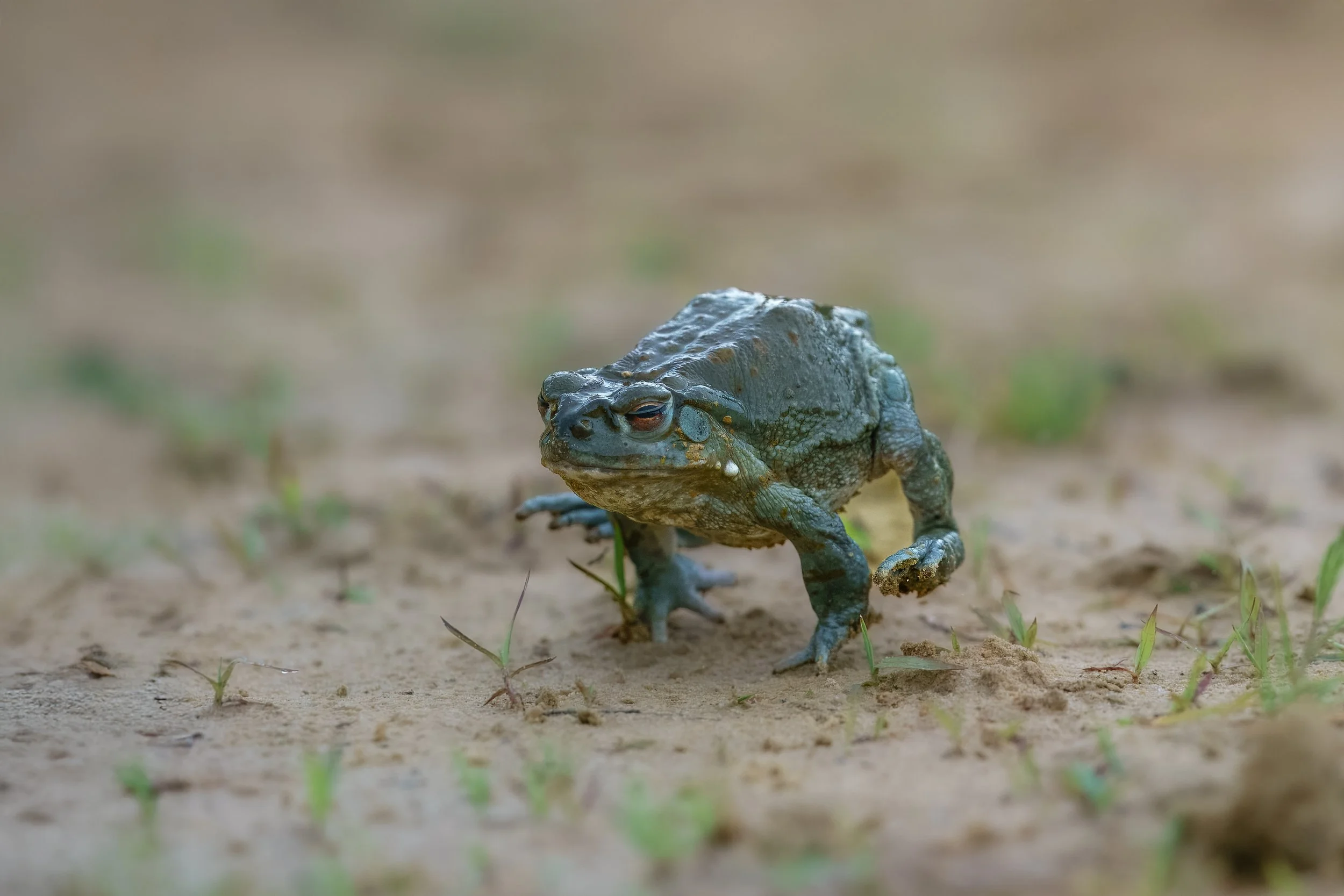
sonoran desert toad
incilius alvarius
Access & Community Space
A refugia network can act to expand equitable access to the outdoors by protecting dwindling green spaces that support the community’s health and well-being, and foster land stewardship through ecosystem ecosystem restoration, recreation, and education
Learn more about our engagement process here.